Amantia: Ancient Capital & Federate of the Illyrian River Dwellers
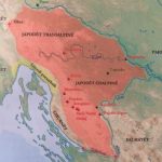
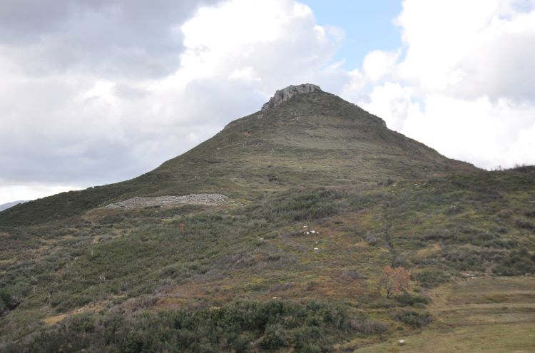
Amantia was an ancient city and a small state inhabited by the southern Illyrian tribe of the Amantes. The city stood on a peak in the Kudhësit mountain range, current southwest Albania, 613 meters above sea level. Amantia was also used to name the region and federative state controlled by the Amantes, consisting mainly of the middle valleys of the Shushica and Vjosa Rivers.
Euboean vs proto-Albanian toponym
Pausanias, Plutarch, Pseudo-Scymnus, and Stephanus of Byzantium link the name “Amantia” with the Abantes, the Ionian population of Euboea. According to the author from Byzantium, the letter “b” of the Abantes from Euboea was switched to “m” by the “barbarians” to form “Amantia”.
Some modern scholars have suggested the name to have the Indo European root “ab” or “ap”, meaning “water” or “river”. Demiraj rebuilt its ancient form as “abna”, in proto-Albanian language meaning “river”. The proto-Albanian “abna” is similar to the old Irish “aub” and Latin “amnis”, also meaning “river”. Norbert Jokl, based on similar premises, believed that “Amantes” as the name of the population meant “river dwellers”; the toponym “Bregalumas” in current Albanian language. The toponym “Amantia” is still preserved nowadays in the form of the name “Amonisë” for a village near the ruins of Amantia at Plloçë.
Amantes as “river dwellers” fits perfectly with the area occupied by this tribe. Notably, the Amantes dwelled in the lands between the valleys of two major rivers: Shushica (ancient Argyas or Polyanthos) and Vjosa River (ancient Aoos).
Amantia and the Legends of the “Returns”
Amantia (region) and the Amantes are linked with the legends of the “Returns” (“Nostoi”), semi-legendary events that occurred after the fall of Troy. Most classical authors establish connections between them and the Abantes of Euboea. It’s unclear if this connection is solely based on the resemblance of the names Amantia and Abantia or there is factual truth behind it.
Pausanias gives the most reliable account that suggests an Euboean presence in Illyrian Amantia. According to him, the Abantians, a tribe of Euboea, together with some Locrians, on their return from Troy, sailed with eight ships into the Acroceraunian (Llogara) Mountains. Here, they occupied the hinterland and established a city called Thronion, as the chief-town of the original Locrians who dwelled in the Parnassus mount. Scholars have agreed to the existence of the Amantian Thronion and located it in the ruins of the Kanina castle. Pausanias’ story of foundations echoes later in the work of Étienne of Byzantium.
Lycophron, in his work Alexandra (dated 270-260 B.C.E.) writes that Elephenor, mythical king of the Abantes of Euboea established his adobe in the Illyrian Amantia. This took place after he accidentally murdered his grandfather Abas (eponymous of the Abantes) and was expelled from Euboea as a result. In Lycophron’s cryptic poem, Elephenor finds the city of Abantia/Amantia in southern Illyria already established.
Lycophron’s story of Elephenor contradicts that narrated by Homer in the Iliad. In Homer’s work, Elephenor is killed in the walls of Troy. He thus must miss in the legends of “Returns”. However, both Alexandra and the Iliad are artistic works and as such have limited historical context.
An Illyrian Ethnos
The Euboean presence in the region of Amantia is recorded in other authors such as Plutarch, Pseudo Schymnos, and Stephanus of Byzantium. Notably, Oricus, a town within the realm of the Amantes, was initially founded by colons from Eretria in Euboea. From Apollonius of Rhodes, who mentioned Abantes, inhabitants of the Acroceraunian Mountains, as neighbours of the Amantians (natives) we infer that the terms Abantia and Amantia does not have to be mutually exclusive.
Instead, as in Lycophron’s poem (supported by uninterrupted archaeological legacy in situ), some Euboeans, who migrated in southern Illyria, may have met and later fused with the native population at some point during Hellenic migrations. Unlike the case of the neighboring Apollonia, the urban Amantia was developed and occupied by native Illyrians. In this same context, a unified political micro-region also called Amantia emerged; controlled by the ethnos of the Amantes which all classical sources accept as Illyrians.
Topography & Economy
Amantia’s location corresponds to the current village of Plloçë in the region of Vlora, in southwestern Albania. The settlement controlled the strategic neck of Sevasteri where the road coming north from Bylis continued south into Epirus. For many isolated Epirote towns, this was the only road that connected them with the prosperous city of Apollonia. The Amantes took advantage of their transitory position between the Epirote hinterland and the Illyrian seacoast to develop their urban centers.
The city of Amantia took its earliest urban shape during late V – early IV century B.C.E. Early on, it counted on the slave-owning economy, but not only. The area where the Amantes dwelled consisted of both large mountain ranges as well as lower lands appropriate for agriculture. This meant it provided ideal conditions for the development of animal husbandry; mountain pastures for the summer season and nearby coastal areas for the wintering of cattle.
Enough findings of local ceramics suggest that the citizens of Amantia developed since the IV century B.C.E. their own ceramic workshops. Craftsmanship was an important aspect of the city on the steep hill. Production of tiles and especially the cutting of limestone blocks were the main specialties of Amantia’s craftsmen. Because of the lack of natural plateaus, Amantia had to count on the ingenuity of local masters to create artificial plateaus. These plateaus were created by organizing the city into human-shaped terraces edged by supportive walls. Over the new ,levelled plateaus new public buildings and houses were then erected.
Amantia as a Federal Organization
Pseudo Scylax is the earliest recorded author to report on the Amantes. According to his “Periplus”, compiled during 350-340 B.C.E., the Amantes were an Illyrian tribe, a branch of the Bylliones. This author included the small harbor of Oricon (modern Orikum) at the foot of the Acroceraunian range into the region of Amantia. Apparently, the coast along Oricon represented the sixty states stretch of coastline that Strabo later awarded to the Amantian region.
Throughout much of their recorded history, the Amantes were politically organized into a federal state (the so-called koinon) and not into a polis. That meant a wider authority of the city of Amantia into other nearby cities, a relationship that formed a federative state labelled Amantia. Some scholars, based on pieces of information from Strabo, Pseudo-Scylax, and Aristotle, have proposed the presence of an extra-federative state composed of three federates: Bylliones/Bylliaca, Amantia, and Atintania. At the head of such an organization were for some time the Bylliones and, for a limited period, the Atintanes. The relationship between Bylis and Amantia are more evident.
Federal borders of Amantia
From all literal and archaeological evidence, we have a clear sense on the territory covered by the Amantes i.e. Amantia. Thus, the northernmost bordering town was Selenica (ancient Nymphaeum). From Selenica, the mid-stream of the Vjosa (Aoos) served as a natural border up to Matohasanaj (east) and Dukaj (the most southeast possession). The border then turned west by following the Bença River. Then, the imaginary line that passed through Nivicë, Mesaplik, Brataj and Dukat marked Amantia’s southern border. From Dukat, the border turned northwest following the stream of the Dukat River (ancient Kelydnos at the foot of the Acroceraunia) that then met the sea at Oricon. The coastline Oricon-Kaninë (ancient Thronion)-Vlore (ancient Aulona) represented the western border and likely the coastal corridor mentioned by Strabo (the line corresponds to Strabo’s 60 stades or about 11 kilometers stretch of coast). The border continued north in between Kanina and Mavrovë (ancient Olympe) following the Shushica River (ancient Argyas/Polyanthos); until it joined the Aoos and arrived near Selenica; thus enclosing the whole border-circle.
Turning the extent of Amantia into the ancient political map then, the entity of Amantia bordered the lands of Apollonia in its northwest; those of Bylis and the Bylliones in north and northeast; the koinon of the Atintanes in southeast; Chaonia in the south and southwest; and the coast of the Adriatic in the west (or “Oricia” of Pseudo-Scylax). Apart from the bitumen-rich Nymphaeum, all other towns circling the city of Amantia such as Aulona, Olympe, Oricon, Matohasanaj, and Nivicë, and Bratja/Cerje belonged to the koinon of the Amantes. The construction techniques in all these fortresses makes them contemporary to the city of Amantia. Their strategic position provided protection on all sides for the city of Amantia as the chief-town of the community.
Institutions of pre-Roman Amantia
The prytanis was the highest magistrate in pre-Roman Amantia. He was likely elected yearly by the boule, or the council, the legislative institution of Amantia. We do not know the number of members in the Amantian boule but it seems most citizens had access to its decision-making process. The boule/council had also the secretary (grammateus) who held the third most important office after that held by the prytanis and the priests.
In an inscription from the III-II century B.C.E., a fellowship of relatives (koinon ton syggonon) is mentioned thus confirming both the federative and tribal nature of Amantia. As the chief town, decisions concerning the other settlements across the federate were discussed and moved forward in Amantia; likely in a damiorgie (federal council).
As a federative state, protection of the fortresses surrounding the capital was crucial. From the inscriptions we know the roles of several military officers. The city had a toxarch, commanders of a permanent unit of archers. Also, it had a hipparch/hipparchus, commander of the cavalry unit, likely five hundred strong. The most interesting of the roles was that of the peripolarchos, commander of the border guards. He had the duty of defending the borders of the federate, not that of the city, and thus was stationed in one of the bordering fortresses. Such was an Aratos, a peripolarchos stationed in Matohasanaj whom Alexander, son of […]okleos, addressed in an inscription.
The Games & The Stadium
Another position of high statues in the city of Amantia was the agonothetes, president of the sport activities and competitions. The agonothetes took care of such organizations with his own expenses. This means the seating president came from the most wealthy and, through patronage and sponsorship, made a name for himself. The main sport events took place in the Amantian stadium, accommodating an audience of about 4,000 people. It was here where competition such as discus and spear throwing, running, and other events took place, gathering athletes across the whole Amantia.
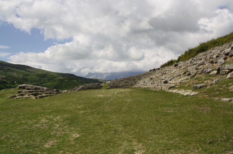
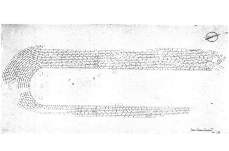
The stadium in the city of Amantia was one of the most impressive structures of the city. It was constructed in the III century B.C.E., roughly two hundred meters below the walls of the acropolis. Eight rows stretched 46.50 meters on the east wing while seventeen rows lied for 44. 50 meters on the west wing. Both wings were connected south by a small stretch of rows that progressed in number east-west from eight to seventeen rows; thus unifying both wings while still reflecting a sense of organization and fine aesthetics. The northern part had no rows; it served as an entrance for spectators. The rows were built with limestone blocks, abundant on the hill of Plloçë.
Of note in the Amantian stadium are the names of some individuals (among them Socrates Apollonos and Iparchos) inscribed on the stone block seats. These were apparently the names of citizens who contributed in the construction of the stadium and/or organizations os games there.
Bits of History from pre-Roman Amantia
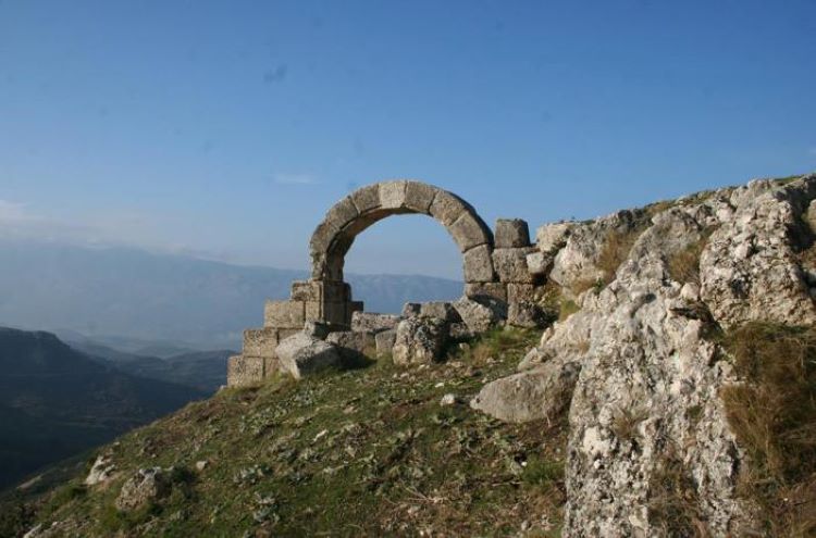
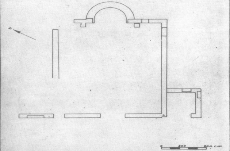
During the first half of the IV century B.C.E., the acropolis of Amantia took its shape. Not all the acropolis of Amantia was fortified, counting in some parts on convenient natural formations. Some interesting architectural features in the acropolis where the gates, enclosed above by a fake arch. A prytaneion/temple occupied once an upper extreme of the acropolis. In general, this period marked an economic and cultural prosperity across all cities of southern Illyria. Amantia, along with Bylis, was by then one of the largest such cities in this region. Not all the acropolis of Amantia was fortified, counting in some parts on convenient natural formations.
The author describing the earliest events involving Amantia was Pausanias, though he wrote centuries after. In the same passage where he described the Euboean sail into Amantia, the author recorded a war between the Amantes and the neighboring Apollonians. There is indication that the war (dated at first half of V century B.C.E.) was fought for dominance over Nymphaeum (current Selenica) and its precious bitumen reserves. The war was won by the Apollonians who pillaged and destroyed the Amantian town of Thronion.
With a tenth of the war spoils, the city of Apollonia contracted the sculptor Lycius, son of Myron, who completed a celebratory monument. This sculptural monument was placed in the Hippodamus near Olympias. As for Thronion, the destroyed city was abandoned and lost in history. The chief-town of the Amantes shifted to Amantia, near current Plloçë, if it had not already shifted.
At the time of Pseudo-Scylax account, the Illyrian kingdom of the Taulantii may have held control over the Amantian region; the nature of this control remains unknown. It’s reasonable to assume a subservience position of Amantia towards the Illyrian kingdom of Glaucias (r. 335-302 B.C.E.), similar to the position of Dyrrachium during this same period.
Independence from Epirus
Pyrrhus of Epirus (r. 306-302; 297-272), who Glaucias of the Taulantii first placed him into his rightful throne, absorbed Amantia into his kingdom. Amantia as part of Epirus echoed in the work of Proxenus. Also, connection with Epirus prompted the historian Antigonus to mention Amantia in his description of Macedon.
After 268, Amantia became independent, marking this by issuing its own bronze coins. A list of theorodokoi from Delphi, dated two hundred twenty-a hundred eighty-nine, confirms Amantia as a separate entity. After the assassination of Deidamea in Ambracia (233), the political separation between Amantia and the new Epirote state became complete.
The federate of the Amantes marked its independence from Epirus by issuing its own coins beginning in 262-230. These hoards, bearing the legend “AMANTON” (replacing “APEIROTAN”) testify to Amantia’s level of economic emancipation. It was at this time when the First and Second Illyrian War (229-228 and 219) influenced new political realities in the region.
Amantia’s Relation with the Roman Republic
As the Romans expanded their interest in the region, the Amantes repositioned themselves politically. Thus, they increase relations with the neighboring Apollonians, with whom once they had clashed for the Nymphaeum. Since Apollonia was in friendly ties with the Romans, the Amantes received the same treatment by the Republic. The increased ties with Apollonia are evident from the discovery of numerous Apollonian coins in Amantia and surroundings; as well as the modelling of Amantia’s own coins based on some degree to contemporary Apollonian coins.
Later events reveal that Amantia’s detachment from Epirus and increased ties with Apollonia saved the federation from potential punitive actions. Of note is that Amantia preserved its relationship with the northern city and federation of Bylis. Thus, from Titius Livy we can infer that the Amantes supported the Roman army in the fight against Illyria and Macedon in 168 B.C.E. The following year, when countless villages and towns across Epirus (especially Molossia) were destroyed and pillaged by the Romans, Amantia was evidently spared.
The Amantes also supported Caesar in his war against Pompey (49-48 B.C.E.). However, following Caesar’s victory and then the principate of Augustus, the city of Amantia lost its military character. Notably, the walls around the acropolis turned idle, no longer used as defense.
The alignment with Roman benefited the Amantes in the following decades as well, in the form of an expanded internal autonomy within the Roman Republic; on a formal level, Amantia became part of the Roman province of Epirus. The federative institutions were gradually dissolved, those remaining only governing the city. Indeed, the city of Amantia was awarded early on, as Apollonia, the status of a civitas libera. For a long time into the Roman Republic and then Empire, Amantia maintained its homogenous/indigenous composition among its citizens. Unlike Bylis, the city of Amantia did not receive contingents of Roman veterans as colonists.
Amantia under the Roman Empire
The destruction of urban settlements in the Epirote hinterland after the Third Macedonian War (171-168 B.C.E.) had its toll on the Amantian economy. The city could no longer profit as before from connecting this hinterland with the coast. Furthermore, the construction of Via Egnatia north during the I century C.E. bypassed the routes near Amantia, further decreasing its importance.
Until recently it was believed that the city of Amantia did not host contingents of Roman settlers. However, an inscription belonging to the II century C.E., in the late Antonine period, suggests otherwise. According to this inscription, written both in ancient Greek and Latin language, Publius Pomponius Aelianus, a Roman citizen, constructed a public granary for the city. The construction seeked to help Amantia in a time of shortage.
Despite Aelianus’ philanthropy, there are no indications of a permanent and proper Roman colony in Amantia. Thus, as other cities lacked such colons, the city gradually fell into obscurity. During the reign of Diocletian (244-311 C.E.), Amantia was included within the new province of Epirus Nova; that’s about it on the Amantia during this time.
Procopius of Caesarea listed Amantia among the cities reconstructed by Justinian (r. 527-565). These works focused on rebuilding Amantia as a military center. Centuries later, under the Amantian walls reconstructed by Justinian, the Byzantine army faced in battle the Saracens.
In late Antiquity, there was a bishop see in Amantia. The ruins of a Paleo Christian church have indeed been discovered in the site. Yet, by the beginning of the Medieval Age, Amantia was abandoned completely, though it’s name was not forgotten.
“Thence, fleeing from the terrible warfare of the serpent-shaped vermin, he [Elephenor] shall sail to the city of Amantia, and coming nigh to the land of the Atintanians, right beside Practis shall he dwell upon a steep hill, drinking the waters of Chaonian Polyanthes”. (Lycophron, Alexandra, MXXXIII).
Bibliography
Anamali, S. (1972). Amantia. Iliria. Nr. II.
Cabanes, P. Disa Çështje mbi Amantët (Interrogations sur les Amantes). Iliria. Nr. XXXV. pp. 75-98.
Ceka, N., Ceka, O. & Tare, A. A Peripolarchos Inscription from the Castle of Matohasanaj.
Lycophron, Alexandra, MXXXIII
Pausaniae. Descriptio Graeciae. V. XII. Elis.
Procopii Caesariensis. De Aedificis. IV.
Scylacis Cariandensis. Periplus. Orikoi.
Trushaj, A., Sina, E., & Jaupaj, L. (2015). New Inscription of Illyrian City Amantia as Political-Historical Source. Academic Journal of Interdisciplinary Studies, Vol IV, Nr. II. MCSER Publishing, Rome-Italy.
